A 4x4 self-drive adventure in the Sary-Jaz Valley in Kyrgyzstan (Ak-Suu region)
Content
Key information about Kyrgyzstan at a glance
| Daily budget: | ca. 30-60 EUR/person/day if self-traveling, tours start at 80-100EUR/person/day |
| Transportation: | either in you own 4x4 or with a tour |
| Itinerary length: | 3 - 7 days - check our full Kyrgyzstan itinerary |
| Best time to travel: | mid-June to mid-September |
| For you if: | You love nature, hiking, camping and being in very remote places |
| Not for you if: | You hate camping and being completely alone |
| Country Overview: | Head here for a general overview over Kyrgyzstan |
When I first came across the Ak-Suu region and the Sary-Jaz valley on a map of Kyrgyzstan, I was intrigued. It looked incredibly beautiful, yet when I researched it, I only found a few sparse organized tours and a Red Bull Article about a crazy Kayak Excursion. If you are like me and always look for beautiful, yet remote and little travelled areas - you have just discovered the ultimate bucket list destination.
Map Overview
To orient yourself throughout this article and all the locations mentioned here, let's first take a look at a map of the region:
About Sary-Jaz, Khan Tengri National Park and the Tian Shan Mountain Range
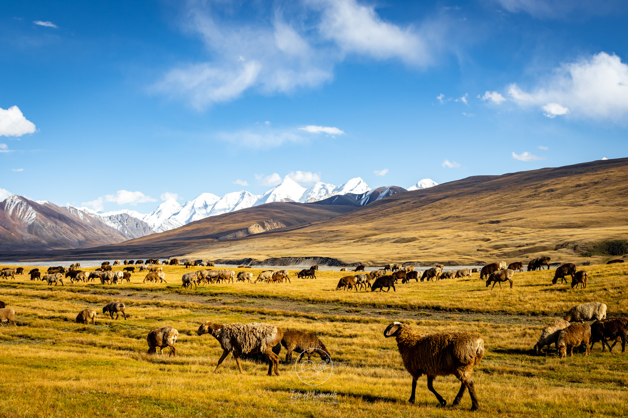
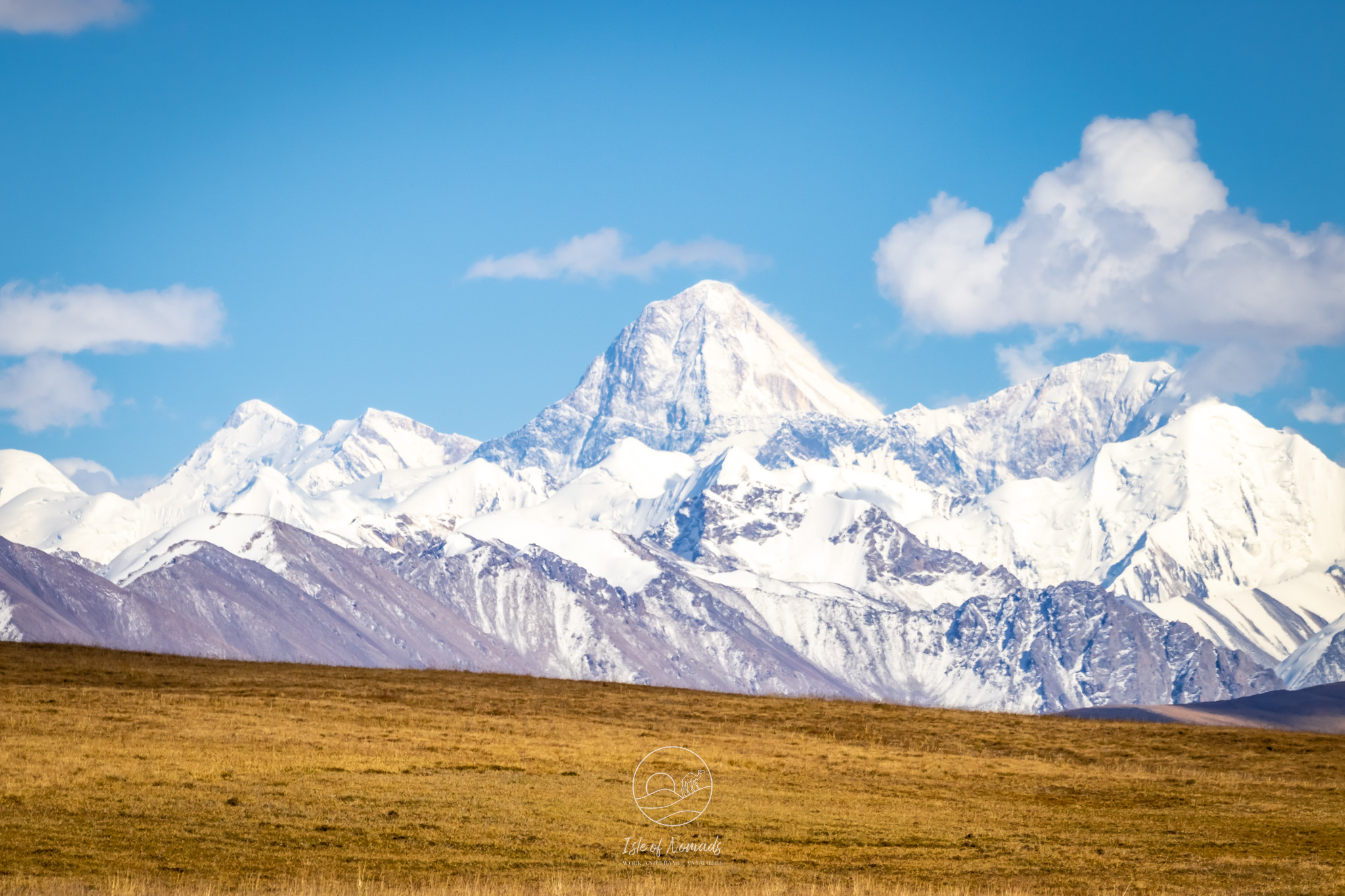
The Sary Jaz region is part of the Ak-Suu District in Eastern Kyrgyzstan. The Tian Shan mountain range - meaning the "Mountains of God/Heaven" - stretch through the entire region and across the border and into China. The two most impressive peaks are Jengish Chokusu (7'439 m) and Khan Tengri (7'010m). On the Kyrgyz side, the whole area is part of the Khan Tengri National Park and hence protected.
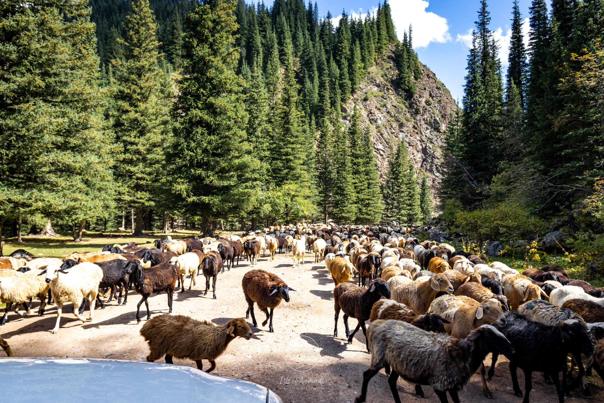
Incredibly, the territory of the Natural Park is still little affected by human activities, and the main landscapes have remained almost in their natural state. For centuries, the only people that temporarily live in this region are the nomadic people of Kyrgyzstan that move here every summer to graze their sheep. In the winter, the region is not accessible and completely uninhabited.
How to get to Sary-Jaz
There are only two ways to get to Sary Jaz: You can either join an organised (trekking-) tour, or you take a 4x4 car and drive yourself.
As this article will focus on the self-drive option, let me just say a few words on the tour option: There are a few smaller agencies and guides that take adventurers, climbers and trekkers into the mountains - for example, this 4x4 one, this hiking one and another one in a car without much hiking. Most often, the trekking ones will climb either Khan Tengri or Jengish Chokusuu. These peaks are incredibly high and require both an experienced guide and a very high base fitness level (also, you really have to really love climbing and hiking). For us normal mortal beings, these multi-day climbs are off-limits, but there are several smaller hikes and walks you can do if you self-drive.
The gateway to the Ak-Suu region and Sary Jaz is Karakol. When we were looking for a good 4x4 car to rent, we did not find anything reliable in Karakol, so you will need to rent your car in Bishkek. When you get your car, don't forget to check the tyre quality and that the spare tyre is in good shape, too. The distance between Bishkek and Karakol is 400km and around 5-6h if you drive non-stop - however I highly recommend that you stop several times on the way (see our Kyrgyzstan itinarary article for more info on this!).
You cannot drive into Sary Jaz valley without a good 4x4 car. We ended up getting a Toyota Fortuner: this was much too big a car for 2 people, but felt it was exactly the car needed for our drive - the Renault Duster we had in Kazakhstan would probably not have made it up some of the hills and across some of the rivers. Our car rental was Аренда Авто Бишкек and we were very happy with them.
General tips and safety precautions for your trip to Sary-Jaz
First, a general word of caution: There is no institutional mountain rescue in place in Kyrgyzstan. As the region you are driving into with this itinerary is very remote, it will be almost impossible to alert someone if something goes wrong while you are there. Hence, I would advise that you never attempt to do this trip alone - travel with a partner or, even better, in a group. Do not take any risks if you go on one or more of the hikes mentioned here. If you are going for several days, consider taking a satellite telephone with you.
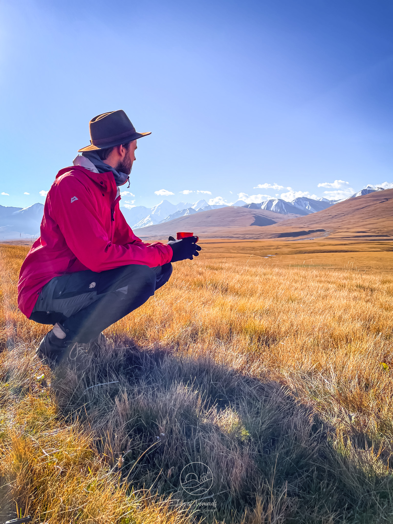
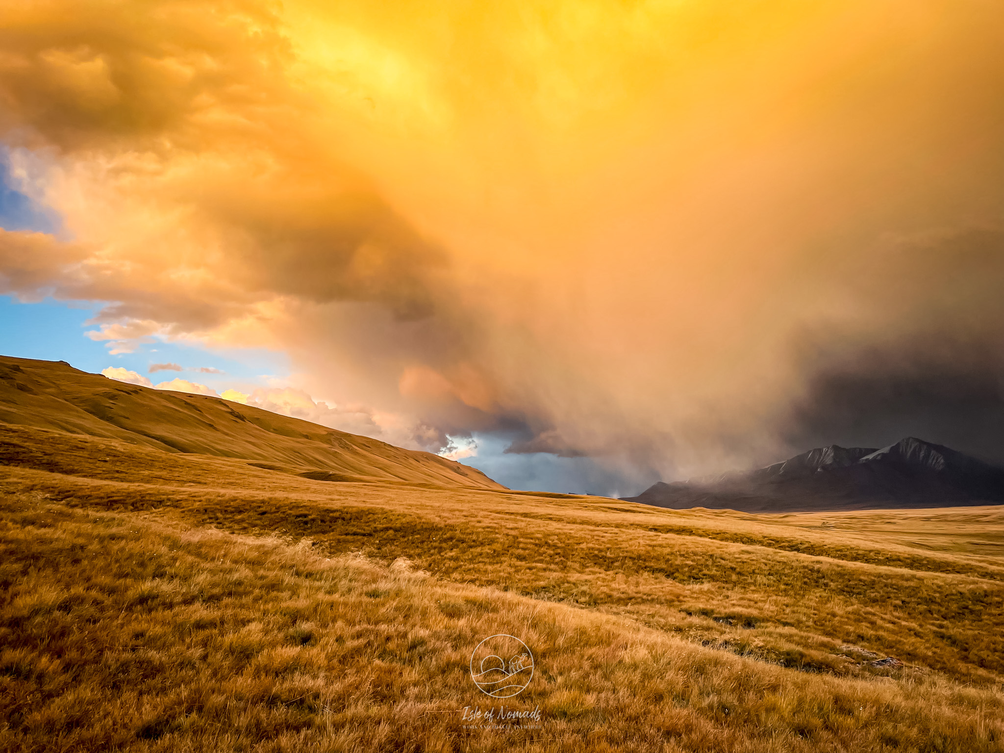
Do not underestimate the cold and the unpredictability of the weather. We did this trip end-August and it was freezing (I am not kidding, our tent froze over during the night). Even though we got good sleeping bags, it was still a bit too cold during the nights. If in doubt, get a thicker one, and take layers. The weather is very unpredictable - it can be sunny and around 20 degrees, but it can also drop to -5 without much of a warning.
Do not drive at night. With many crevaces and steep turns as well as the occasional river crossing, it's simply too risky.
Do not underestimate the altitude: Driving this itinerary, you will cross over passes that are around 4000 - 4500m high, and you will pitch your tent likely on 2500m - 3000m. Take a bit of time to aclimatize in Karakol, if you recently flew into Kyrgyzstan.
In the whole of Kyrgyzstan, but especially in remote areas, it is very common for the locals to hitchhike. At first we were a bit wary to pick up someone on a meadow in the middle of nowhere after we had not seen a soul for kilometres, but in general, it is super safe, and people rely on the occasional car to get from A to B. We ended up enjoying all of these encounters - using google translate we learned that we gave a monk, a carpenter and a group of women travelling to a nearby market a lift.
If you follow our itinerary, there will be two checkpoints you need to pass - one on your way into the region and one out of the region. You will need to show your permit (see below), car papers, driving license, international driving license and passports. Sometimes, your car and luggage might be searched (but to us this only happened in the Naryn region). If you do not speak Russian nor Kyrgyz, be ready with your offline translation app to be able to communicate.
There are no gas stations on the route that you will drive. This also means that if you meet someone, they are likely to ask whether you have a bit of petrol you can sell them, or whether they can take some out of your tank. The first few times we did not understand what they were asking :-D If you are going for several days, you definitely need to take additional petrol. Also, there is no cellphone signal for 95% of the route.
Do not trust Google Maps - it does not work in Central Asia. To navigate, we used maps.me, downloaded the maps we needed and marked the route we were planning to drive with pins. The app is consistently bad at estimating durations for driving though, we usually were much faster than it indicated. Just use common sense to estimate how long you will need to drive a certain distance (if it's off-road or a very bad road, we usually average 35km/h).
Getting ready for the drive
Like in almost all the border regions of Kyrgyzstan, you need to apply for a permit to enter the Sary Jaz Valley. We tried to find out how to make this happen ourselves, but after quite a lot of researching and talking to people we gave up - if you do not speak Russian or Kyrgyz, it is quite a headache. This means you need an agency to apply on your behalf. We used the biggest one, Visit Karakol. Our permits that included both the Sary Jaz valley and the Naryn region (to visit Kel Suu lake) and we paid 70USD per person.
It's advised to apply early for the permit - usually it takes around 2 weeks (10 working days) - for the them to be ready. The process is quite straightforward. Simply contact Visit Karakol via WhatsApp and they will take it from there. You can either pick them up in Bishkek, or in Karakol.
You need to spend at least one day in Karakol before you drive into the valley: Use this to stock up on all the groceries, water, and - if you are going for a longer drive - petrol you will need for your time in the mountains.
And, of course one of the most important things: You need gear! (If you didn't bring it from your home country) We rented ours with EcoTrek-Trekking & Travel. Their gear was not the best, but it did the job, and the owner was very friendly and gave us many tips on the drive we had planned. If you have a lot of hikes and independent travel in the mountains planned, it might be advisable to rent your gear in Bishkek. Even if you get your gear from Bishkek, it is worth stepping by EcoTrek to ask about the current conditions in the mountains.
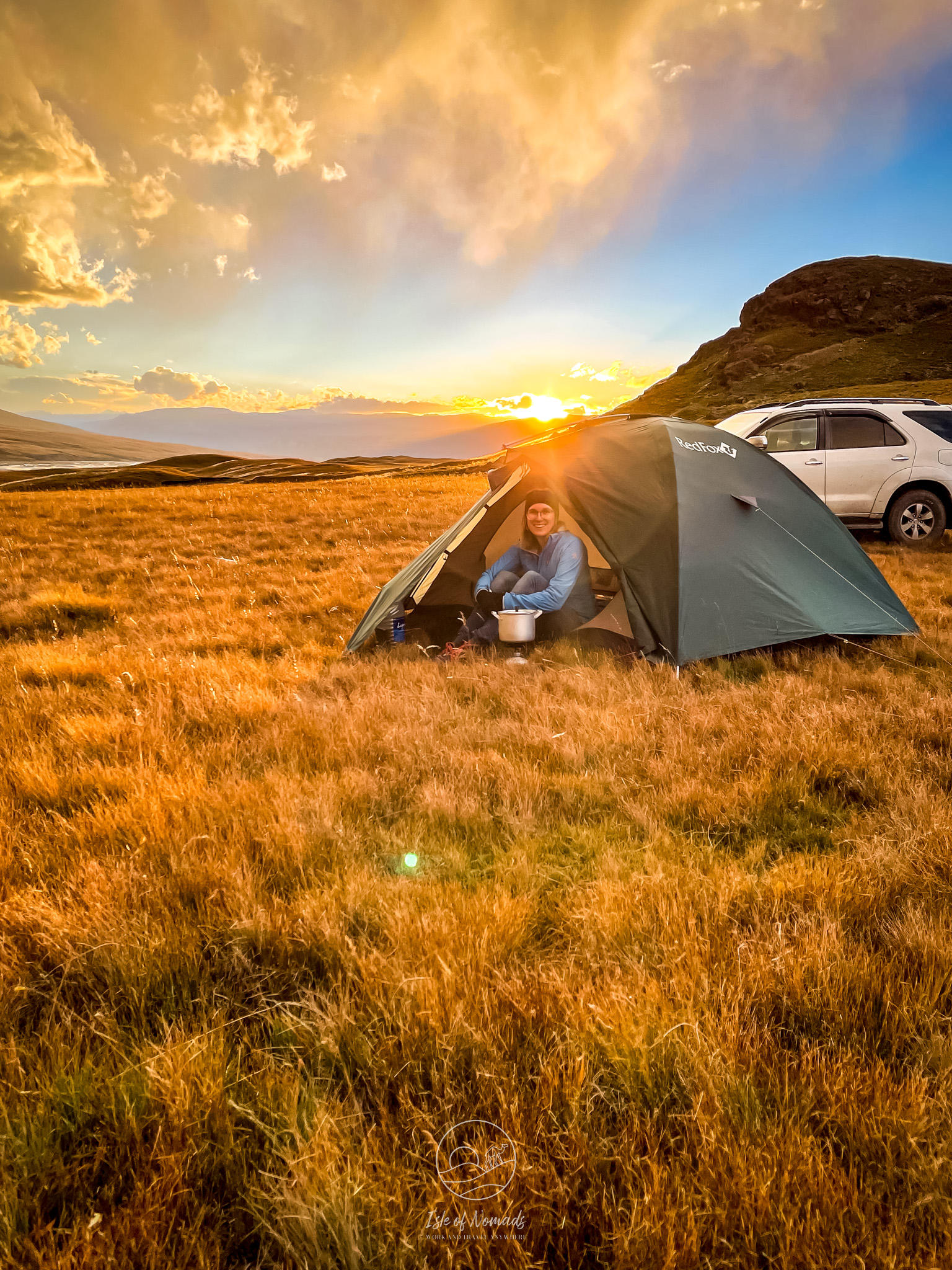
We took the following gear - you might need to adapt this depending on how long you stay: 1 tent, 2 sleeping bags, 2 mats, a cooking pot and cutlery, a gas camping stove. Lastly - make sure you have all the maps and apps you need downloaded on your phone as well as a spare battery pack (or two)!
What to do in Sary-Jaz: Possible itineraries
I am including the coordinates of the different places mentioned here so you can insert them into maps.me.
2 day itinerary
Quick note: This is the itinerary that we did, as we had little time, are not terribly fond of camping, and did not want to take any extra petrol. I researched the other itineraries deeply as well though and if we ever make it back to Kyrgyzstan, a longer trip in this region is the first thing I would include. If you end up driving one of the longer routes, I'd love to hear from you to see how it went!
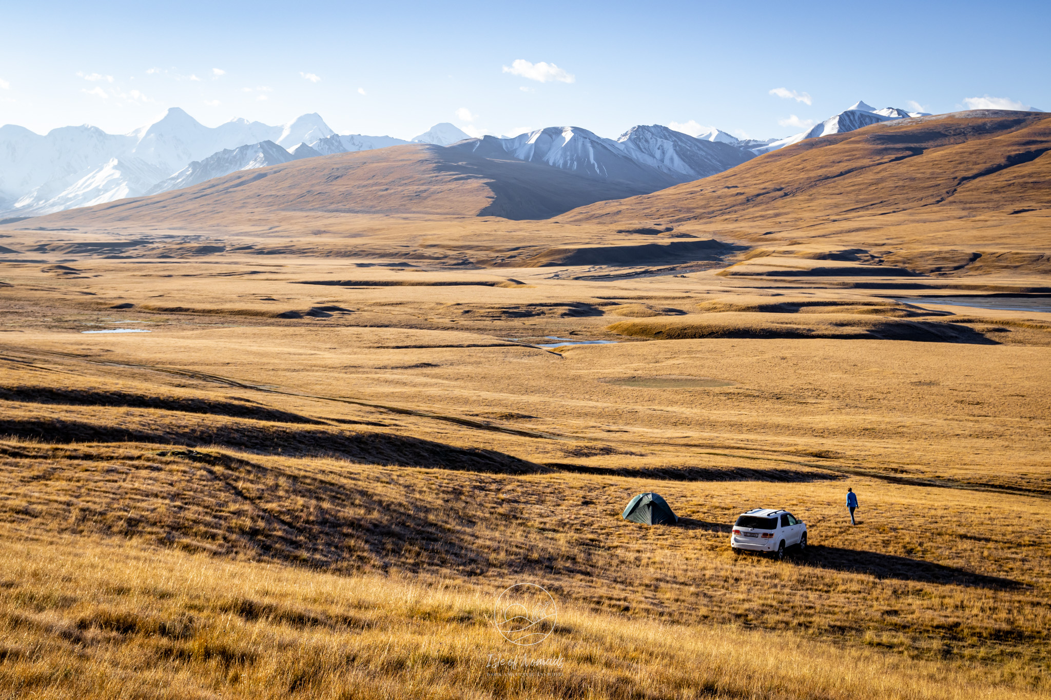
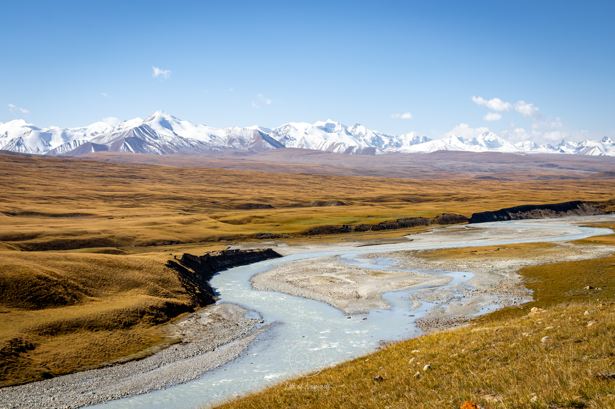
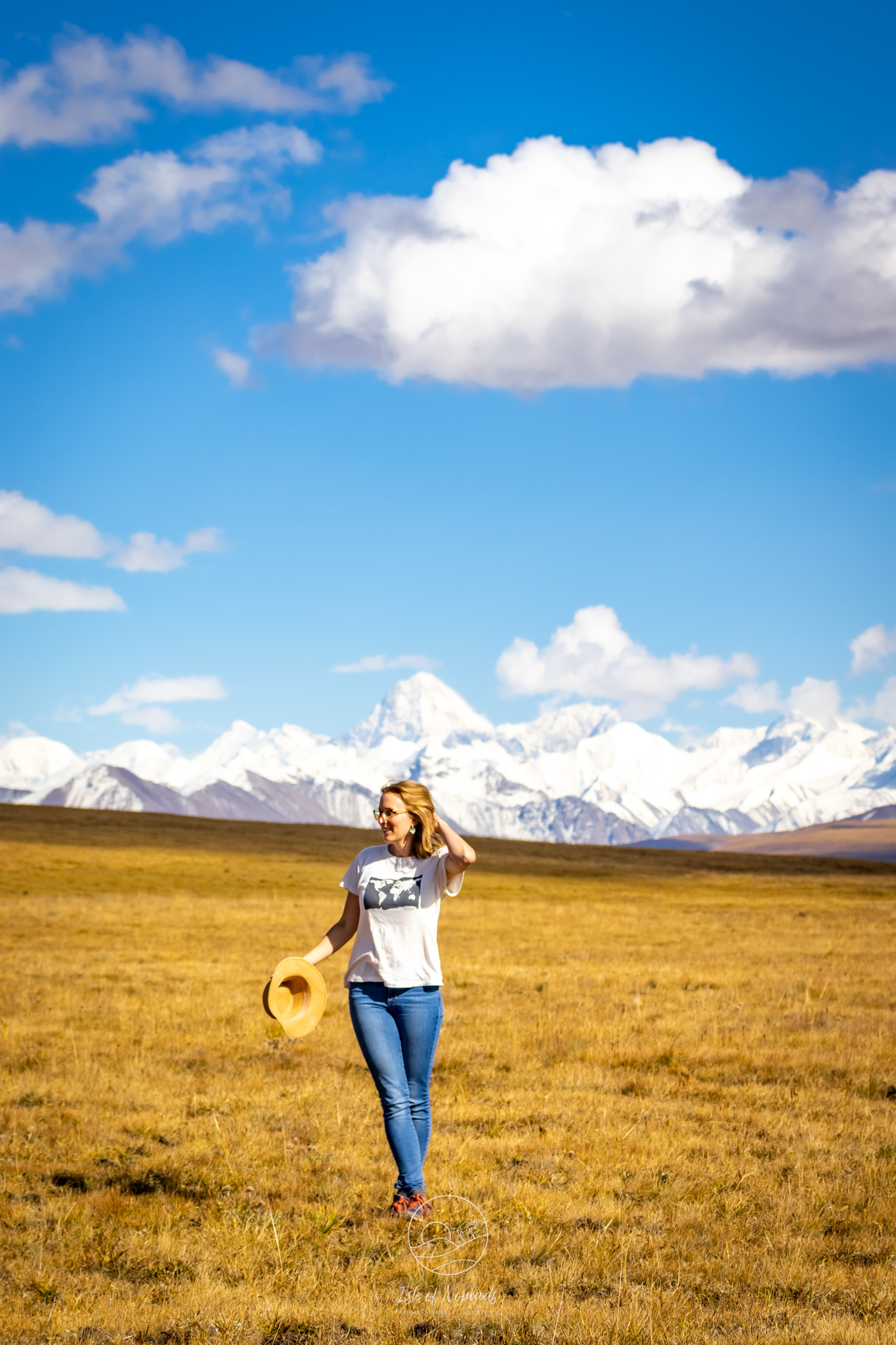
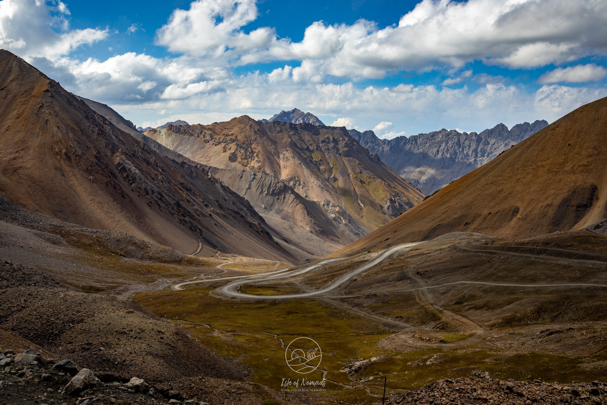
On day 1, start early (7-8am) and drive the 80km from Karakol to Karkara (Каркара; 42.756334, 79.168011). There, you will pass the first border control post. Continue along the route as it runs directly on the border to Kazakhstan. You will drive over a high plateau after ascending the Ak Tog Pass - be on the lookout. Once the 7000m high peaks of the Tian Shan appear on the horizon you will know why you went through all the trouble of getting a permit and renting gear and a 4x4. The view of the endless steppe with the peaks in the distance, and you as the only human for miles took our breath away.
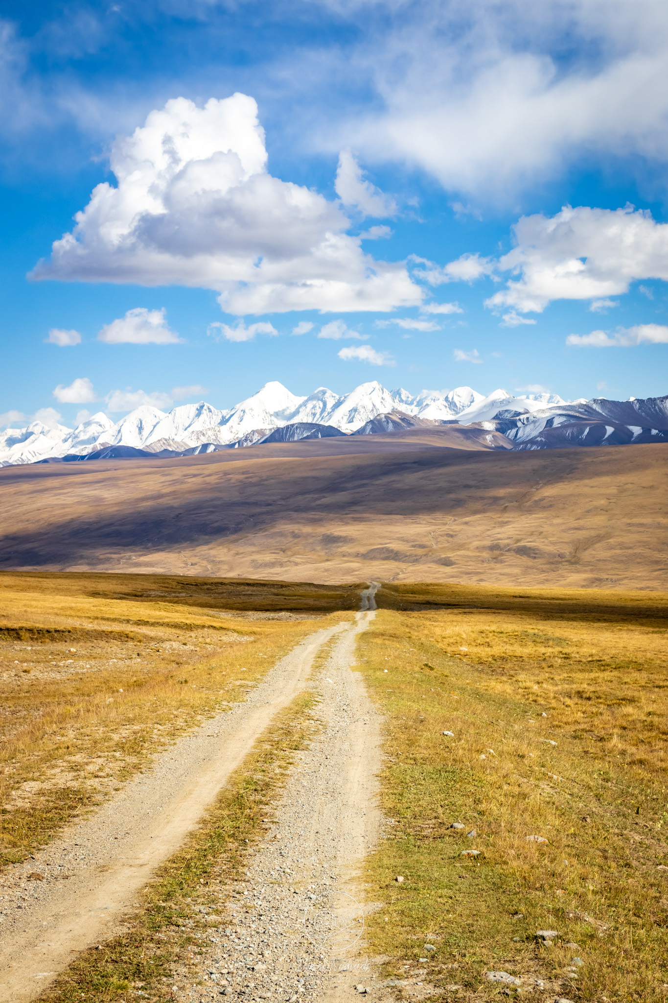
After you cross the high plateau, you will drive down to the valley and likely come across a few yurts and small settlements. At the foot of the mountain (42.392235, 79.452028), turn left and drive a bit upstream of the Aksu River (towards 42.402061, 79.495862). You can drive quite a while upstream, but you should start looking for a place to spend the night. Pitch your tent wherever you think is most beautfiul - we settled on a spot around coordinate 42.39883, 79.549449. Depending on how often you stop, you will reach this spot in the afternoon at around 3-4pm.
For the rest of the day, set up your camp, enjoy the view, maybe take a short walk, and make dinner. As there is not much to do after it gets dark, call it an early night. Don't forget to peek out of the tent at the stars though if you have a clear night. They're beautiful this far from any bigger cities' lights!
On day 2, pack up your tent and start your drive towards Enilchek (42.030217, 79.081907). Make sure you stop at the river to take a small stroll.
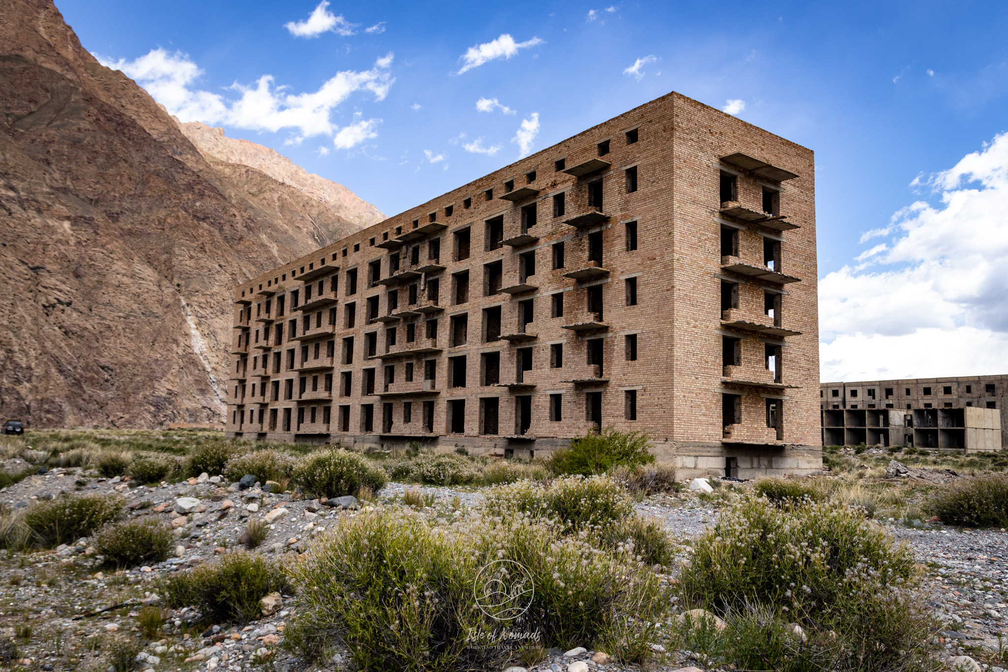
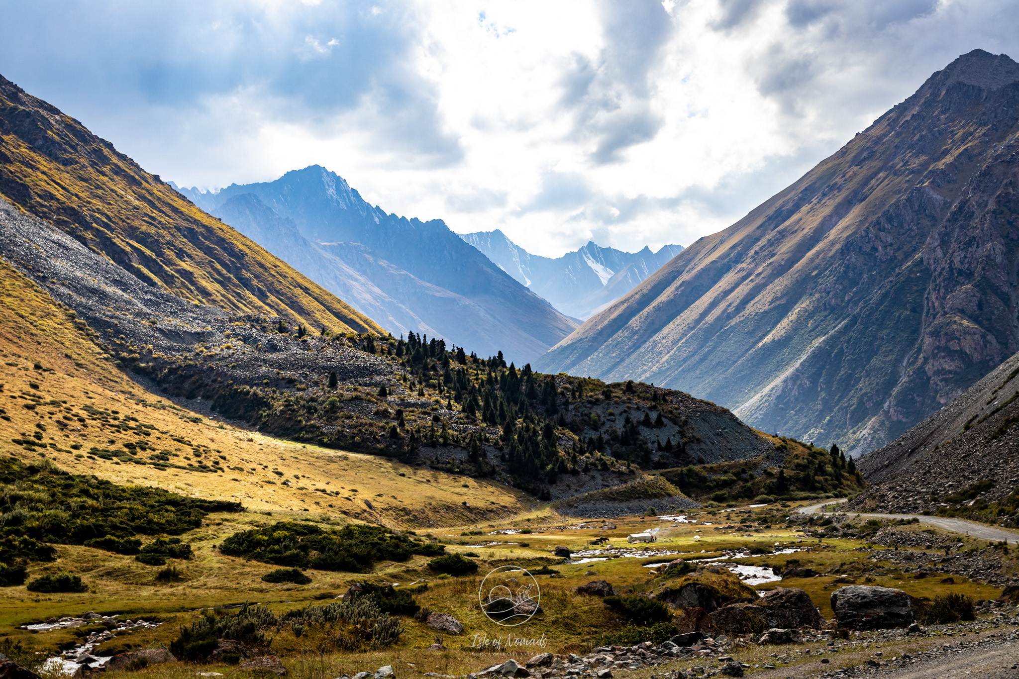
You will pass the Echkili-Tash Border Post at coordinates 42.347308, 79.367068, where you need to show your border permit again. Continue driving straight until you reach the crossroads at 42.248973, 79.123243. Turn right - it's time for a detour to go see the abandoned mining town of Enilchek (42.030217, 79.081907). During the Soviet era, this was a bustling town of around 5000 inhabitants, most of them employed in the tin mine. After the collapse of the Soviet union, most of the population moved away and today a mere 140 people still live in the town. Most of the buildings are abandoned and even in broad sunshine, the brutalist buildings are an eerie sight.
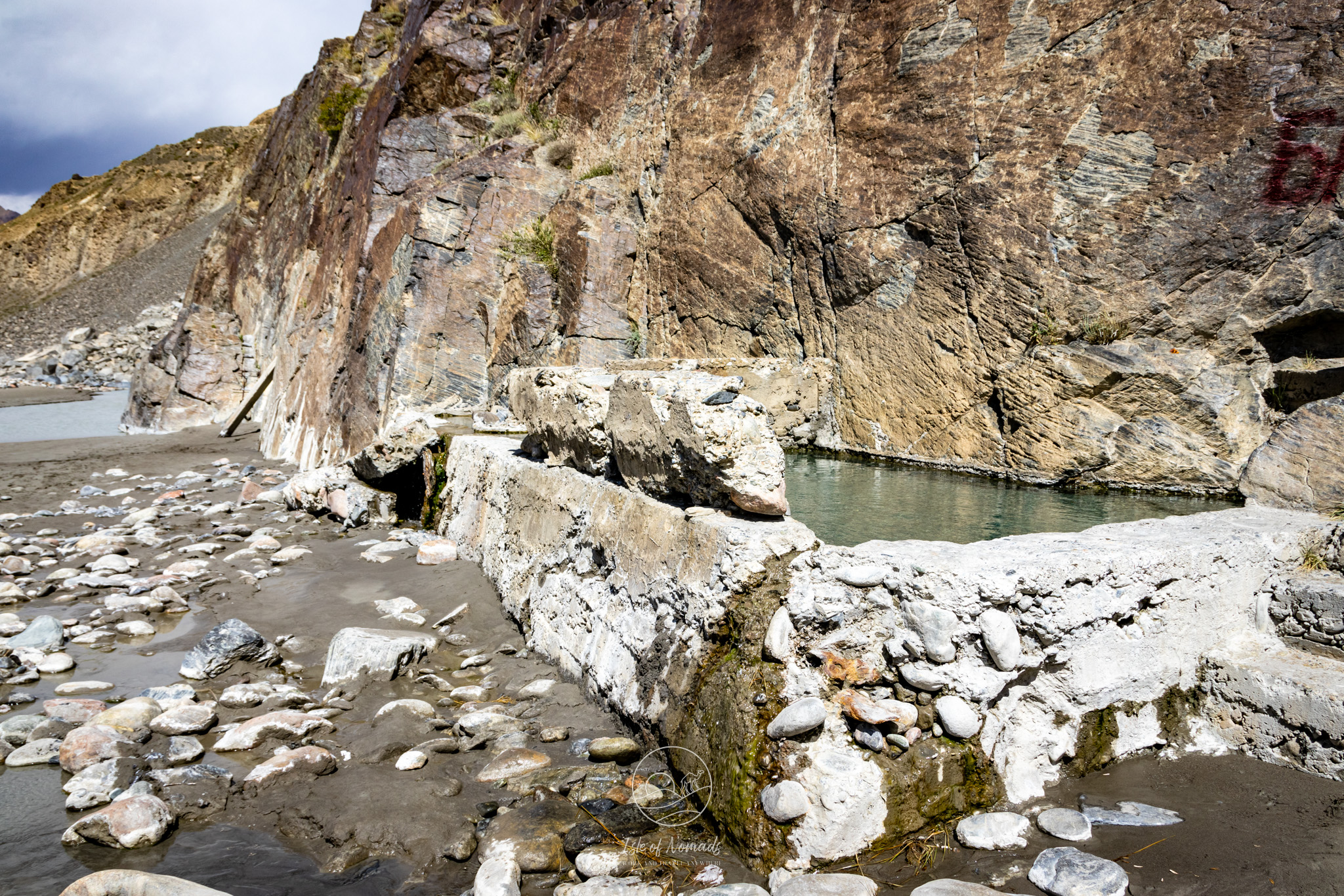
You can drive up to the mine - however we would advise against entering it, as it is very dangerous and could collapse at any time (and not to mention forbidden). We watched this video of a guy exploring it with equal parts of horror and fascination. If you feel like warming up a bit, consider driving a bit further to the Kara-Tash Hot Spring (at 41.994325, 79.079010). In order to access it, you need to leave your car at the top of the hill and walk down towards the river for around 15-20min.
Drive back the way you came and at the crossroads continue straight back towards the town of Ak-Bulun. The road gets much better here and is even partially paved. On your way, you will cross a beautiful mountain pass (at around 42.390010, 79.049829) and then enter the valley of Turgen Jailoo. At this time we were getting a bit nervous about our dwindling petrol indication, so we unfortunately did not stop as often as we would have liked to. If you can, we advise that you take a lot of time stopping and taking small walks, the landscape is one of the most beautiful ones we've ever come across.
The first offical gas station is once you are back in Karakol, but if you are on the verge of running out you could definitely buy some from the nomads you encounter on the way.
4-6 day itinerary
Follow the itinerary above until you reach Enilchek. In Enilcheck, take the road along the Engilcheck river upstream (the road starts at 42.04149921622739, 79.11952090254954). I've heard that the road is passable with a 4x4, but could include some tricky river crossings if it has rained in the past days - if you want to make sure, check with people in Enilcheck before you attempt to drive it.
Drive towards the Camp Tuor Hhan Tengri - if you wanted, you could write them on WhatsApp and see whether you can spend the night there instead of in your tent (Tel. +996708407821). On your way there, you will pass another military checkpoint. The mountaineering tours to Pobedy Peak (7,439 m) and Khan Tengri (7,010 m) start here, so you might encounter other adventurers (that could also pull your car out of a river if you get stuck! :-D ).
Spend the night somewhere around Camp Tuor Hhan Tengri. In the morning, you could hike a part of this trail - it looks gorgeous! It has a total length of 22km (13.6 miles), meaning you could either spend the whole day hiking and spend another night at the camp, or just partially hike this and then make your way back to Enilchek.
Either on your way in or out of the region, drive to and spend a night in Jyrgalan. With several jurt camps here, it is much more accessible and there are quite a few beautiful hike (e.g. [this one] (https://www.alltrails.com/explore/trail/kyrgyzstan/ysyk-kol/turnaly-kol-lake)) that you can do here.
If you have 6 days, I'd advise you hike the trail mentioned in the 4 day itinerary or check Wikilog and pick a medium long trail that is on your way.
P.S: We know this route - and Central Asia in general - is still a lesser travelled destination. So don't hesitate to reach out if you have any questions, we're happy to help! Similarly, if you find the information here is outdated or we're missing something don't hesitate to get in touch) and we'll update it so fellow travelers can profit from this.